Integrated shading
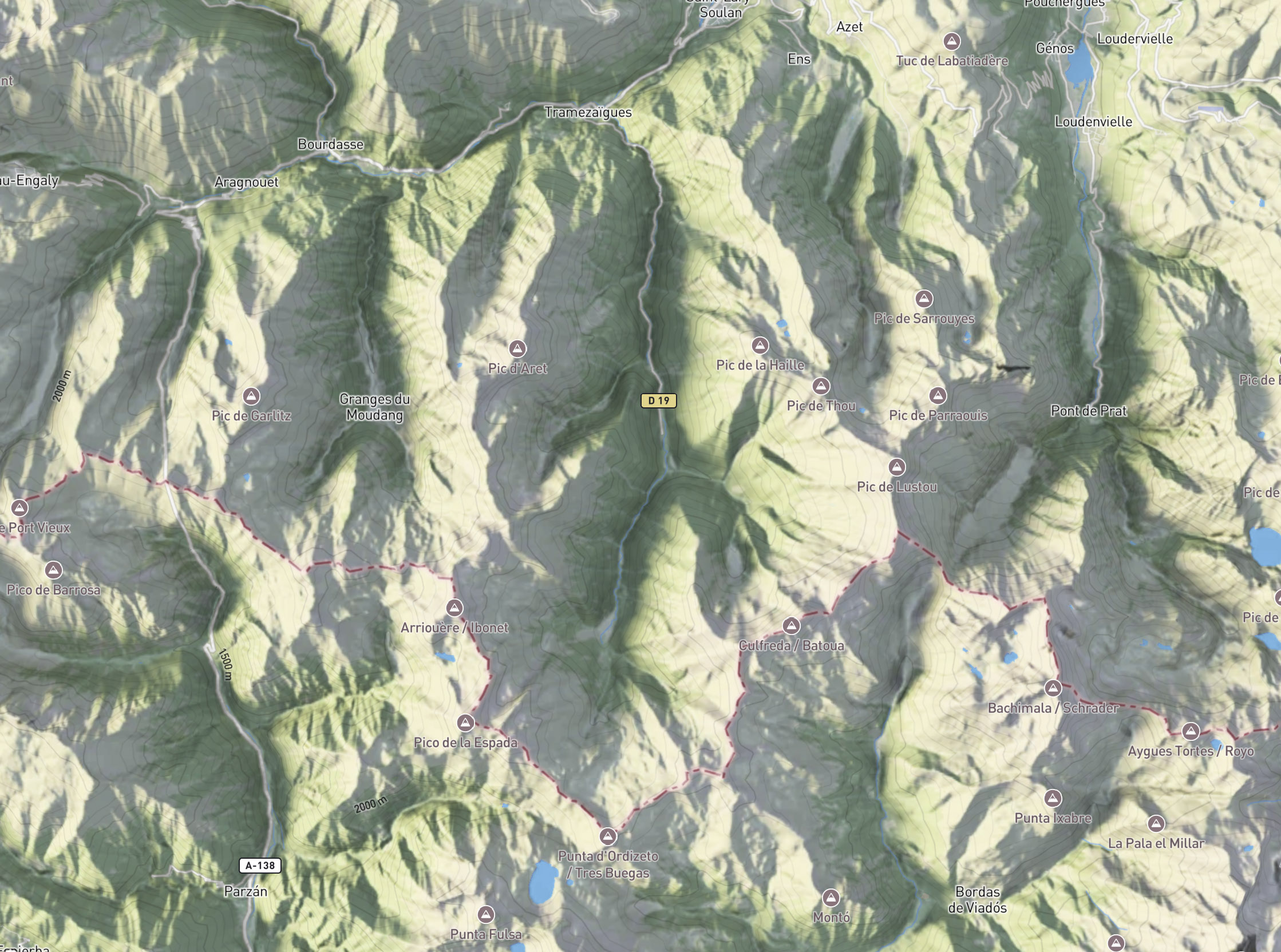
Roads, paths, contour lines, and other interactive vector layers are shaded to blend naturally with the terrain. This makes them feel part of the map surface rather than floating above it.
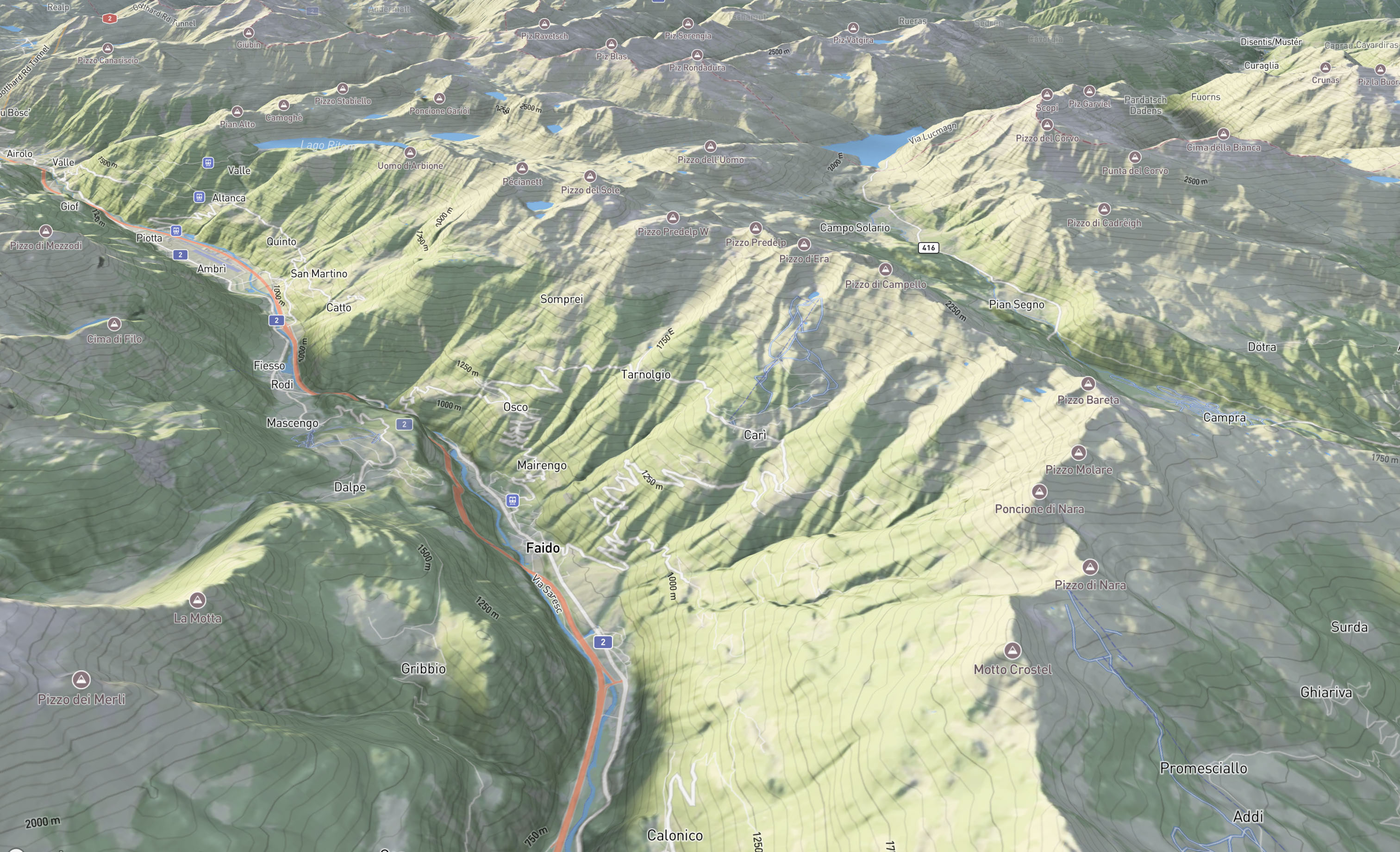
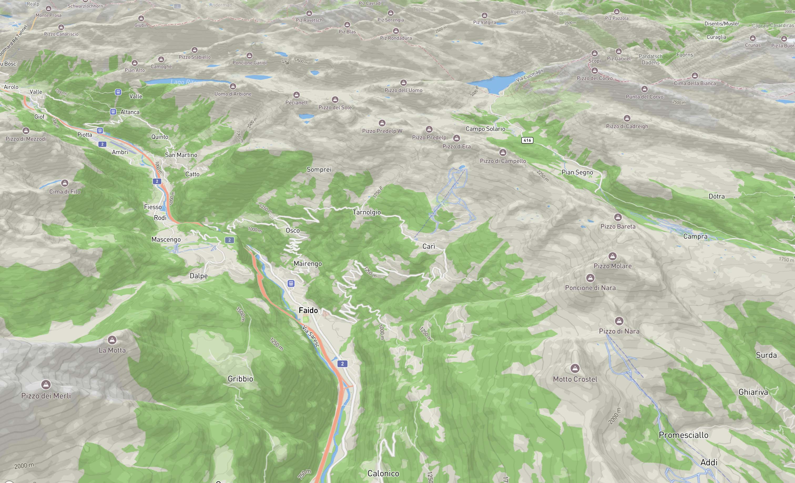
Compare the standard Mapbox Outdoor style with shaded terrain maps. Realistic shading and surface texturing create a stronger sense of place and reveal subtle details about the landscape. Map functionality and interactive content remain unchanged.
Roads, paths, contour lines, and other interactive vector layers are shaded to blend naturally with the terrain. This makes them feel part of the map surface rather than floating above it.
Global and up-to-date land cover data defines the base coloring. Combined with texture derived from satellite imagery, the result gives rich visual detail about the environment.
Shadows emphasize terrain shape. With dynamic shading, shadow intensity adjusts automatically, keeping shaded areas visible and balanced even when zoomed in.
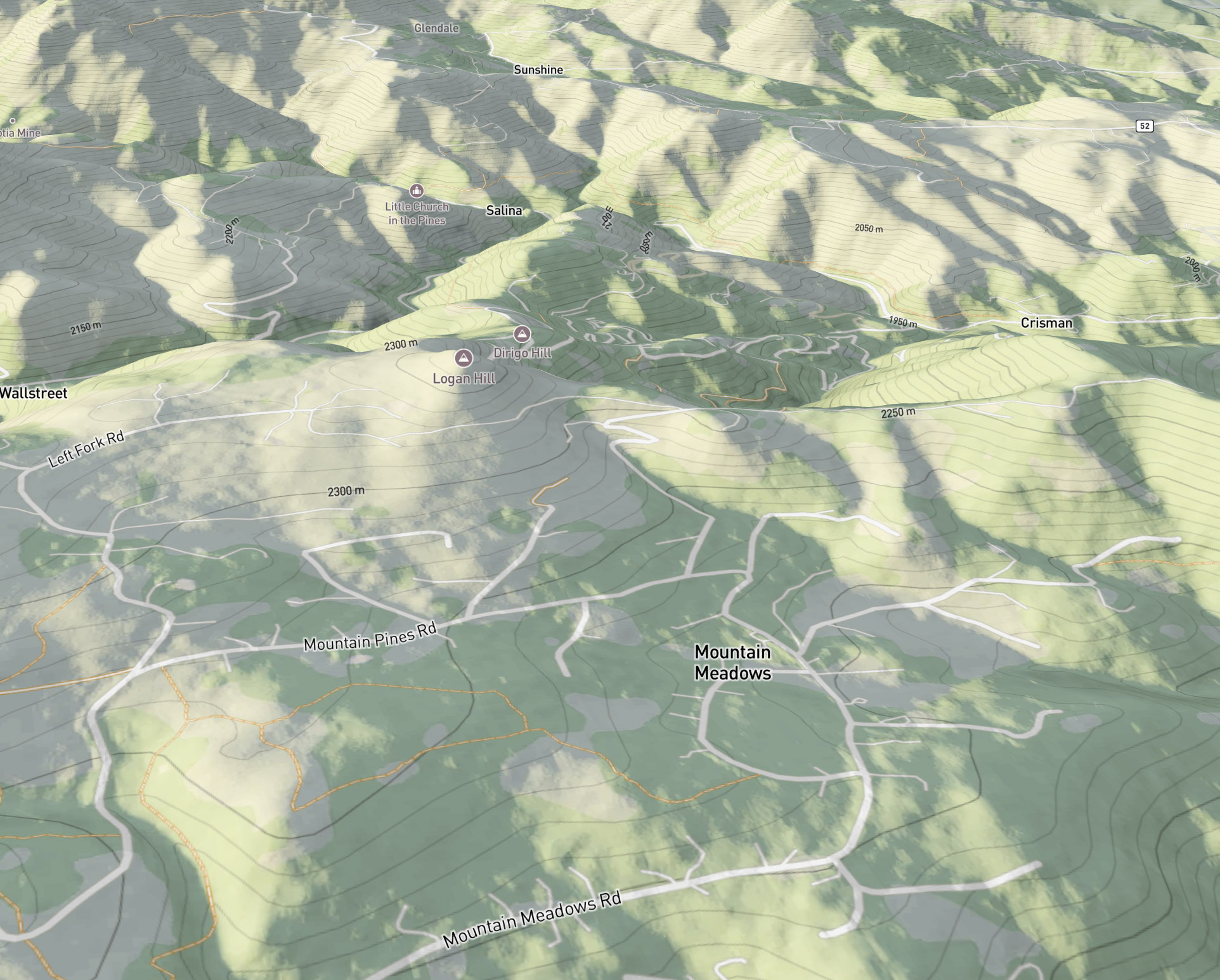
Roads, paths, contour lines, and other interactive vector layers are shaded to blend naturally with the terrain. This makes them feel part of the map surface rather than floating above it.
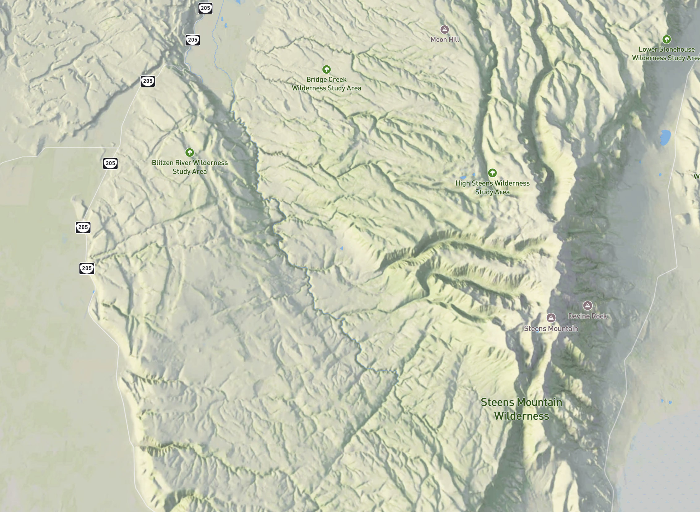
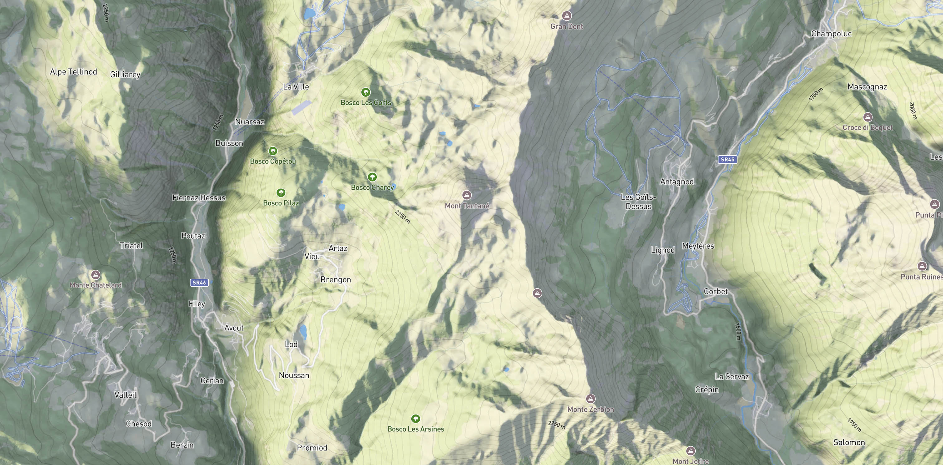
Global and up-to-date land cover data defines the base coloring. Combined with texture derived from satellite imagery, the result gives rich visual detail about the environment.
Shadows emphasize terrain shape. With dynamic shading, shadow intensity adjusts automatically, keeping shaded areas visible and balanced even when zoomed in.
Add shaded maps by simply replacing the default Mapbox Outdoor style. The tiles are provided as optimized WebP rasters up to zoom level 15, offering high visual quality with efficient file size. They’re encoded to support the basemap and dynamic shading directly within the Mapbox style.
The maps can be tested for free, and the dataset is available to purchase for self-hosting.
Get an access key and use the style URL below for testing.
const map = new mapboxgl.Map({
  style: 'https://api.vulcanmaps.com/v1/styles/outdoor/shaded/default?key=YOUR_API_KEY',
  ...
});
The Vulcanmaps rendering engine uses a ray-tracing and global-illumination model to produce soft shadows and natural lighting. It’s optimized for global map rendering and outputs ready-to-use raster tilesets. Terrain data is generated from global elevation models, satellite imagery, and land cover datasets.
By adjusting lighting parameters and color palettes, a bespoke map design can be created, matching your application's visual identity and use cases.